Pages

Sunday, August 31, 2014

Moonville Tunnel, Vinton County OH


The concept of this blog boils down to one thing—how weird it is to compare what’s here now with what was. If we go back just a few hundred years the chances are pretty good wherever you’re reading this post was just part of the unbroken wilderness. The landmarks around you simply didn't exist—no grocery store, no McDonalds, no “weird 7.5-way intersection.”

As civilization slowly moved across the continent people gravitated either to where it would be easy or profitable to set up shop. Sheltered bays on the coast, along rivers, rich timber, or mineral deposits. As anyone who’s played any Sid Meier game knows, there are only so many “perfect” spots to build a settlement. As a result, it doesn’t take long to start settling on the next-best spots, close to the really good ones. Think about how you may live in an affordable part of town, but work in a nicer area.

After a couple hundred years of this cycle, we have giant metro areas where settlement after settlement piggybacked on an initial “perfect” spot. These suburbs grew out of nothing because once upon a time the initial city had jobs—and we stay because the jobs are still somewhere in this metro area. If not, we’d leave—think about the mass flight from Pittsburgh since the decline of US Steel, or Detroit as the Big Three consolidate. 
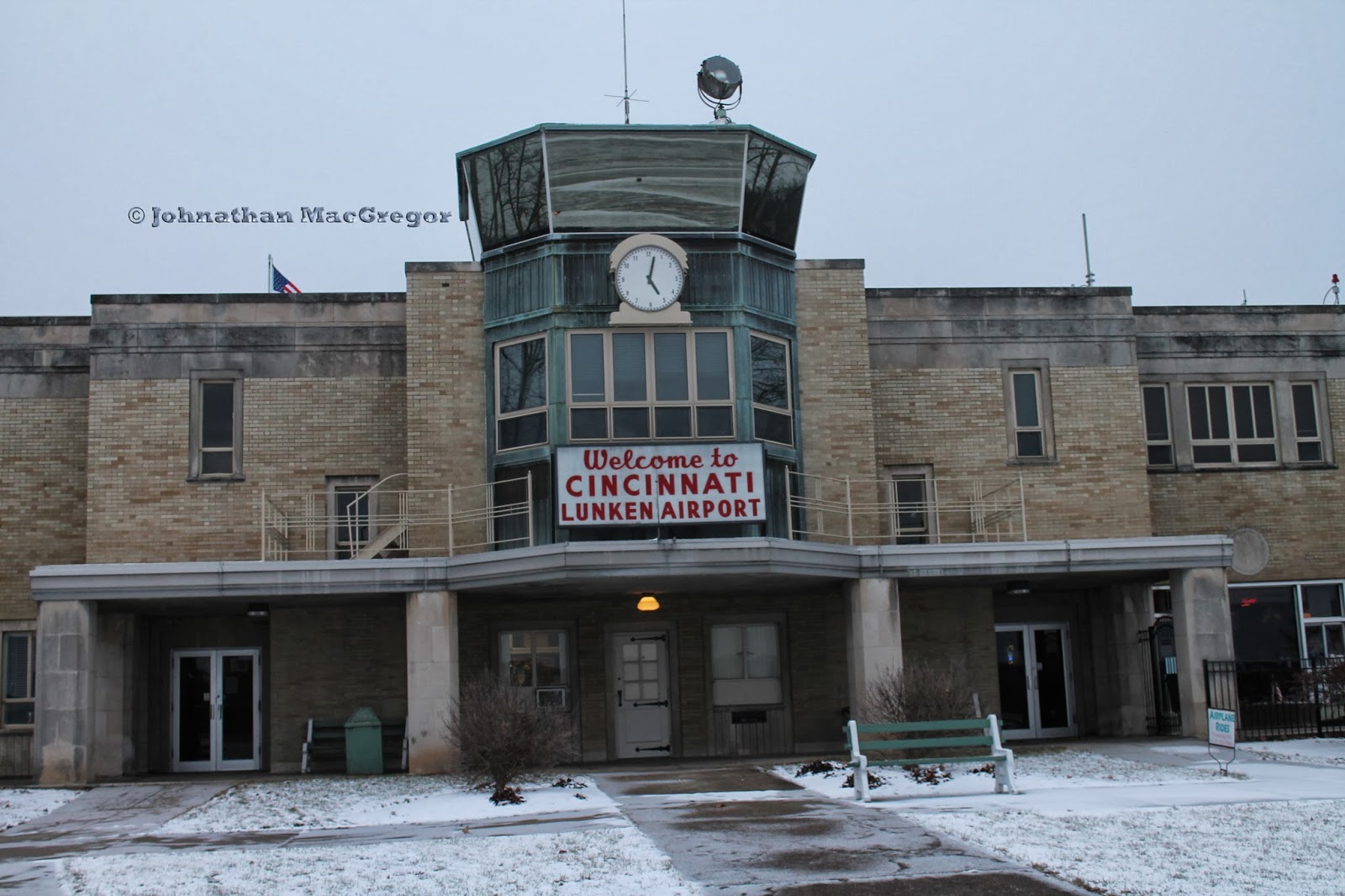

This brings us to the Moonville Tunnel in Vinton County, Ohio.


First, the area was all forest. Then the American colonists started pushing West in search of a wilder land with more opportunity. Small homesteads were carved out of the forest, fields were planted, trails and roads grew. This was followed by the mills, the government buildings, the places of commerce needed by any decent sized group of people. But it wasn't the most convenient place to settle—far from rivers, lakes, mountains with minerals. The population stayed small, remote, and underdeveloped compared to cities like Cleveland, Cincinnati, or Pittsburgh.

Then iron ore was discovered in the rocks in the area, and the boom was on. Iron furnaces such as the one at Hope, OH were constructed. Men and material flowed in, creating boom towns all over the region. The area’s remoteness was now offset by the profit that could be made, and for nearly 100 years the development reflected it. Since there was no easy, natural route like a river to get the iron out after smelting (the industries fed by iron weren't located anywhere nearby, remember), railways were financed to bridge the many creek beds and tunnel through the many hills.

Then the iron boom tapered off, eventually into nothingness. The trains hadn't been in the area before the boom—the needs of the population wouldn't cover the expenses of fuel and track maintenance. Once the iron furnaces had all closed and Southeast Ohio returned to pockets of small rural communities many of the railways simply stopped service to this remote area. This is how we end up with places like the Moonville Tunnel, named after a town that no longer exists and built to shelter tracks long ago removed for use elsewhere.


Moonville Tunnel is a perfect spot to practice the surreal act of trying to reconcile how things are now with how they must have been.


Several of these poles were on either side of the tunnel, near the old right-of-way. Considering how good of shape they're in (considering), my hunch is they were from the tail end of the rail line's existence, rather than the original telegraph cables.


Playing with the shutter speed to get the best view--this is a long exposure that gives you a bit of a feel for the over all scale.


Erosion will remove all things, over time--but considering this was put up 112 years ago, I think they did a find job setting the foundation of this wall.


Short exposure reveals just how dark the tunnel gets--I mean, it IS a tunnel. It begs the question--was there any lighting? What kind? It's easy to see how the stories of conductors falling off trains and switchmen getting run over without a sign can be started from the depths of such darkness.

Wednesday, April 16, 2014

Discover Bridge, Broad Street Columbus over the Scioto River

It took Cincinnati almost 60 years to collectively decide they even needed the Roebling Bridge to be built. A big part of that was simply being unable to build a bridge tall enough to let steam ships cruise under--the Scioto didn't present this problem, and Columbus began bridging it early. Four years after Columbus was officially founded, Lucas Sullivant built a toll bridge on the same general site as the current bridge.

Not the Sullivant toll bridge, clearly.
As it turned out, the Scioto was extremely hard to bridge because it kept flooding. As the plaque a few photos down will tell you, at least 6 bridges have spanned this spot, as well as others in different places throughout the city. It took quite a while to find one that would stick around, but in 1918 work began on the span that would bridge Broad Street until 1990.


A lot was done to that 1918 bridge, including taking out streetcar track after WWII and building in telephone cables under the sidewalks. Between that, increased vehicle traffic (compare the number of cars on the road when they designed the damn thing with the number of cars on the road today for an unscientific assessment), and general wear-and-tear on lowest-bidder construction it was time for a new bridge for a new century.


I'm a fan of private industry, but I can't help but notice bridges didn't stick around longer than a few years until the government took the wheel--probably a coincidence, but still interesting to note. What role does protecting ROI (return on investment) play in projects like this? Just food for thought as we privatize everything from prisons to highways...


I'm a huge fan of bridges, and dams, and things in general that let us grab Mother Nature by the proverbial shoulder and say, "No, no I'm not ok with this--we're going to compromise right now!" It's a bonus when they can look as graceful as this bridge does, with the simple lines and comforting stability. Crossing on foot, I felt no movement from the bridge even when the occasional heavy truck drove by--not something I'm used to.


I was fairly impressed by how clean and spacious the riverwalk is beneath the bridge--and the good lighting and lack of sneaky alcoves means things are likely to stay that way with little evidence. Someone at the architect's firm was thinking ahead.


Simple arches connected to simple columns, resting on simple islands. Just like suspension bridges are just a roadway hanging from ropes strung over towers. The simplest ideas are often the best.

The Discovery Bridge is so named to celebrate Christopher Columbus's discovery of America. Given the absolute horror this unleashed on the people of the Caribbean, South America, North America, and Africa it's debatable just how much we should celebrate such a thing.


It was getting quite chilly as the sun kept going down, and the lighting made photography challenging. The current plan for the downtown stretch of the Scioto is to narrow the river to improve water movement and build more green space along the banks. Based on the smell by the river, even in the cold, I say more moving water is a good thing--but that's exactly how so many bridges were swept away. A tricky balance, and a worthy challenge.


We were getting ready to head out to our nice warm car and enjoy a hot meal someone else cooked, and this pile of trash and rags caught my eye. And it dawned on me that someone had stashed their bed here, in possibly the best place to avoid the wind. It was so incongruent with the effort the city clearly makes to keep things "pleasant" down by the river.

So in closing, I think it's safe to say we've got the whole "build beautiful strong things" down cold as a species. Maybe it's time to take on some other challenges?

Sources:


If You Liked This:

Wednesday, April 9, 2014

Mini Post: Eden Park Reservoir & Pumping Station #7

Eden Park has worn many hats for Cincinnati. One of the more crucial ones was as a water works area during the 2nd half of the 1800's.


The area where Mirror Lake is today was once part of a 96 million gallon reservoir, the most telling evidence of which is the remnants of the wall, pictured immediately above. Water was pumped out of the Ohio River below into the reservoir, and from the reservoir it flowed through the Eden Park Standpipe into the surrounding grid.


Eden Park Station #7 was shut down allegedly due to river pollution in 1907, and was added to the National Register of Historic Places in 1980. I haven't looked hard into it, but my guess (based on research done for the Eden Park Standpipe post) is the tower serves as another standpipe to help regulate the water pressure in and out of the pumping station.


A personal note, the old reservoir wall is pretty spiffy to learn to rappel on. Back in my high school days, my Boy Scout troop had the chance to make an excursion here. Rappelling followed by a trip to Krohn's Observatory covers most of the Scout bases, I think.

Sources for this post:


Wednesday, April 2, 2014

Mini Post: Lunken Aiport

So way back when, after the Wright Brothers but before the Great Depression, the nation began to realize that commercial air transport of goods and passengers was sort of a thing to be encouraged. In 1925, a local "barnstorming" pilot named Dixie Davis established an airfield in what was known as Turkey Bottoms. In a series of moves, the owners of then-Grisard Field in Blue Ash picked up stakes and moved the majority of the operation down to the banks of the Ohio River. The theory was better locale (4 miles to downtown) and a better strategic position would allow for both commercial and military opportunities.


In 1928, the City of Cincinnati floated some bonds and bought additional land for the airport, and started leasing the entire thing from the Lunken family. Brick hangars were built in 1929 in art deco style (this WAS effectively the 1930's after all). The terminal that stands today was started in 1936, which may explain the similarities to Union Terminal across town.


Right down to spiffy paintings rife with symbolism.


And doorways you could pickup from Lunken and drop at Union Terminal without needing to change much beyond the word on a sign. The construction was completed in 1937.


So what could stop a field that once held so many accolades (largest airport in the world, first meal served in flight, first federally approved flight school, etc)? Why do flights to Cincinnati actually land in Kentucky?

The fact Lunken sits in a flood plain might have something to do with it. If you look to the left of the clock in the photo above, you can see a single black brick beside the control tower. That's a plaque that marks the high-water point during construction of the terminal. Between that dramatic reminder of the Ohio River's power, the fog, and the complications of Cincinnati's famed hills on flight patterns further expansion was deemed impractical.

There's a whole side show of drama that relates back to why the main Cincinnati airport wound up in another state...but that's something you can read about on your own for now.

Sources for this post:

Wednesday, March 26, 2014

Church of the Steps, Mount Adams in Cincinnati

So I'm visiting my friend Joe, and I say, "Hey Joe, let's go take some pictures. Know any good places to take pictures?" and as if this was some bizarre Godfather crossover Joe says, "I'll think about it." Luckily for Joe I'm not Clemenza--and luckily for me, Joe knows where to take some good pictures.


Our first stop is up in Mount Adams, specifically at the top of the Mount Adams steps, next to Holy Cross-Immaculata. A Good Friday tradition known as Praying the Steps has given this church another name, "Church of the Steps." Each year on Good Friday, pilgrims gather at the base of the Mount Adams stairway and pray at each step on the way to the crucifix pictured above. Some more background on that can be found here.


The views of the river are the best part of the Cincinnati landscape, in my opinion. This afternoon a snow storm was coming in added an interesting element. Chilly, but interesting all the same.


To the city's credit, Cincinnati does a good job preserving history, even as they revitalize parts of various neighborhoods. Signage on the landscape serves, to me at any rate, as physical footnotes to dig deeper--a clue that this spot was not always as it appears now. A place to start asking questions about what was.


The Mount Adams Steps originated as a path that Immaculata parishioners wore up the hillside to visit the church's construction site. The Archbishop Purcell put in a stair of wooden steps (probably a good thing from an erosion standpoint) and the city took over maintaining the thoroughfare sometime later. The most recent stairway was built in 2009.


When they built the landing with the markers, they included a photo of the skyline. Because there's very little reason not to, I took my own version.


I may not have been able to get the exact same angle and maintain the skyscraper focus but I don't think that really hurts the shot at all. I love how the sign pre-dates the Great American building.

Wednesday, March 19, 2014

Mini-post: Ault Park

Cincinnati has some great parks, and in Mount Lookout there's Ault Park. Created in 1911 and named for Ida and Levi Ault who donated the land and had served on the Cincinnati Park Board.


The pavilion was built in 1930, and in the summer months a fountain runs between the two staircases. It's an impressive, gorgeous structure--the snow fall just added to the charm.


Just a pretty picture of snow showers, with the flag for contrast. The wide open playing fields make the park a hub for activities during the warmer months.


The classy lamps look older than they are, but that doesn't take away from them. This was the point of the evening where the sun was almost down, the wind had picked up, and Joe and I were both ready to hightail it to Coffee Emporium.

Wednesday, March 12, 2014

Hope Iron Furnace

So these days if you're hiking in Southern Ohio long enough, the odds are pretty good you'll stumble along something like this:


It's a reminder that once, about 150 years back for anyone keeping score, the Hanging Rock region of Ohio (a 100 by 28 mile iron-rich area that ran from Kentucky to West Virginia, cutting through Southeast Ohio) provided the majority of high quality pig iron for the United States and beyond.


Fires were built in the base of the furnace with charcoal made from the surrounding forest. Air was forced into the furnace (giving "blast furnaces" their name--blasts of air superheated the charcoal) and melted down the iron ore with limestone. Impurities would float to the top of the molten iron mixture, and could then be removed. This is what we call "slag," and at some furnace sites you can still find it in the ground.

For those of you who have traveled in Southern Ohio and seen how it's all blanketed with trees, think about that. 46 furnaces running full tilt, constantly cutting down trees to use as charcoal. This went on for nearly 100 years, and since the last furnaces stopped operating in the 1910's the forests have come back--that tells you something about how things have gone for the region since the iron boom ended.


Part of why the Hope furnace was built here is the hill it's nestled against--because of the height of the furnace (see photo below) it was easy to build a bridge from the hill to dump the iron and limestone into the top. The stone in the hill also makes me wonder (I couldn't find any evidence of this) if the site wasn't chose because of easy access to building materials.


The Sandy Run river also flows near the site of the furnace, which in the 1850's would have been a key source of transport and power. What strikes me is even after accounting for preservation efforts, this structure is still intact after being left more or less alone for 140 years. The rest of the structures are long gone, and even the adjacent sandstone structure is run down. But it's still not hard to tell what this furnace was used for (at least in a broad sense).


At this time (March 2014) I haven't been able to find definitive explanation for the structure on the right. But, my best guess is a small, less intense furnace for creating charcoal to use in the main iron furnace. I'm going to keep digging into this, because I'm pretty surprised there's no clear answer. It's another big stone structure sitting next to the one the signs and literature speak to, but you're going to ignore it? Very curious.


Try as I did, I couldn't get a really good shot into the furnace. It's not much to look at--years of leaves, fallen stone, wooden reinforcing. Not much that one of the furnace workers would recognize, I'm assuming...tho that might be more because there's no deadly fire inside.


Above the furnace the woods are littered with cut stones, like the one above. At first glance, it's easy to assume it's a cannibalized piece of the furnace...but this looks like a base stone, and getting it 20 feet up a steep hill just to abandon it seems unlikely. It could be a stone from some other long-removed structure--the village of Hope did essentially vanish once the iron furnace ceased production, and the structures that could be salvaged were.

To me it highlights the challenge of archaeology in general. There are a LOT of clues, and clues from multiple eras all exist together. Being able to properly sort them out, and draw the correct conclusion (as opposed to one that supports a pet theory) is the tricky part, and that takes a lot of time and energy.

Sources for this post:

Wednesday, March 5, 2014

Roebling Suspension Bridge--Cincinnati, OH

So everyone knows the Brooklyn Bridge, and how it was designed by John A Roebling. But where did Roebling get the experience to win such a bid? Well, in Cincinnati. Among other places.


One of the spiffy things about Cincinnati's location is how it's directly across the river from a river. This puts the Queen City at a wonderful cross roads--traffic up the Ohio, down the Ohio, from the interior of Kentucky, the interior of Ohio. Cincinnati was briefly considered as a replacement national capital after the British sacked DC during the War of 1812, and the fact it was smack-dab in the middle of all these key waterways (while still being out of range of Royal Marine expeditionary forces) was a big reason.


But all that river traffic was even worse than the current trainwreck that I-75 becomes two-to-four times a day now. Have you seen the steamboats of the mid 1800's? We're not talking a Honda Civic--we're talking a four story building on it's side, getting in the way of everything else that may want to cross the river. That made traffic between Ohio and Kentucky difficult--sure, you could ferry goods and people, but it just added to the congestion in a major way. Not to mention you couldn't always depend on the river to be high enough, or low enough, you needed a place to land those ferries...there are reasons we build bridges, people.


So starting in 1846 (I'm pulling these dates and names from Wikipedia, for the record--as much as I love history I suck at memorizing the details), the Covington and Cincinnati Bridge Company incorporated and called up John Roebling, who'd already designed and supervised the construction of several impressive spans around the country. It wasn't until 1856 that construction actually began--everything from lobbying against the bridge by the ferry operators to slow funding kept things at a glacial pace. Construction kept up at the same rate--between weather, funding, and health issues of key members of the Bridge Company work only took place during maybe a year and a half out of these 4 years.


The Civil War hit, halting construction. However, during the course of building defenses the Union Army built a pontoon bridge across the Ohio--proving to the community that a bridge might be a pretty good idea, after all. This solved the funding problems, and besides an invasion scare construction resumed in 1863. By 1866 the bridge was completed, paving the way for other spans across the Ohio River (see my banner photo).

Sunday, February 9, 2014

New Posts on the Way

A few months of sneaking the camera out whenever I could and practically forcing myself to take pictures means I have some stashed...but haven't quite had the wherewithal to put together posts.

That's changing soon :-)

So stand by, people.