Pages

Showing posts with label Cincinnati. Show all posts

Wednesday, April 9, 2014

Mini Post: Eden Park Reservoir & Pumping Station #7

Eden Park has worn many hats for Cincinnati. One of the more crucial ones was as a water works area during the 2nd half of the 1800's.


The area where Mirror Lake is today was once part of a 96 million gallon reservoir, the most telling evidence of which is the remnants of the wall, pictured immediately above. Water was pumped out of the Ohio River below into the reservoir, and from the reservoir it flowed through the Eden Park Standpipe into the surrounding grid.


Eden Park Station #7 was shut down allegedly due to river pollution in 1907, and was added to the National Register of Historic Places in 1980. I haven't looked hard into it, but my guess (based on research done for the Eden Park Standpipe post) is the tower serves as another standpipe to help regulate the water pressure in and out of the pumping station.


A personal note, the old reservoir wall is pretty spiffy to learn to rappel on. Back in my high school days, my Boy Scout troop had the chance to make an excursion here. Rappelling followed by a trip to Krohn's Observatory covers most of the Scout bases, I think.

Sources for this post:


Wednesday, April 2, 2014

Mini Post: Lunken Aiport

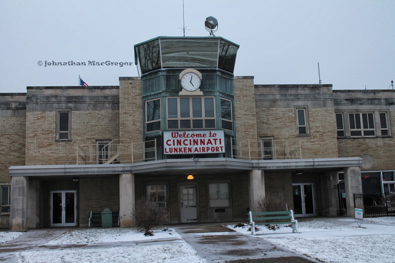
So way back when, after the Wright Brothers but before the Great Depression, the nation began to realize that commercial air transport of goods and passengers was sort of a thing to be encouraged. In 1925, a local "barnstorming" pilot named Dixie Davis established an airfield in what was known as Turkey Bottoms. In a series of moves, the owners of then-Grisard Field in Blue Ash picked up stakes and moved the majority of the operation down to the banks of the Ohio River. The theory was better locale (4 miles to downtown) and a better strategic position would allow for both commercial and military opportunities.


In 1928, the City of Cincinnati floated some bonds and bought additional land for the airport, and started leasing the entire thing from the Lunken family. Brick hangars were built in 1929 in art deco style (this WAS effectively the 1930's after all). The terminal that stands today was started in 1936, which may explain the similarities to Union Terminal across town.


Right down to spiffy paintings rife with symbolism.


And doorways you could pickup from Lunken and drop at Union Terminal without needing to change much beyond the word on a sign. The construction was completed in 1937.


So what could stop a field that once held so many accolades (largest airport in the world, first meal served in flight, first federally approved flight school, etc)? Why do flights to Cincinnati actually land in Kentucky?

The fact Lunken sits in a flood plain might have something to do with it. If you look to the left of the clock in the photo above, you can see a single black brick beside the control tower. That's a plaque that marks the high-water point during construction of the terminal. Between that dramatic reminder of the Ohio River's power, the fog, and the complications of Cincinnati's famed hills on flight patterns further expansion was deemed impractical.

There's a whole side show of drama that relates back to why the main Cincinnati airport wound up in another state...but that's something you can read about on your own for now.

Sources for this post:

Wednesday, March 26, 2014

Church of the Steps, Mount Adams in Cincinnati

So I'm visiting my friend Joe, and I say, "Hey Joe, let's go take some pictures. Know any good places to take pictures?" and as if this was some bizarre Godfather crossover Joe says, "I'll think about it." Luckily for Joe I'm not Clemenza--and luckily for me, Joe knows where to take some good pictures.


Our first stop is up in Mount Adams, specifically at the top of the Mount Adams steps, next to Holy Cross-Immaculata. A Good Friday tradition known as Praying the Steps has given this church another name, "Church of the Steps." Each year on Good Friday, pilgrims gather at the base of the Mount Adams stairway and pray at each step on the way to the crucifix pictured above. Some more background on that can be found here.


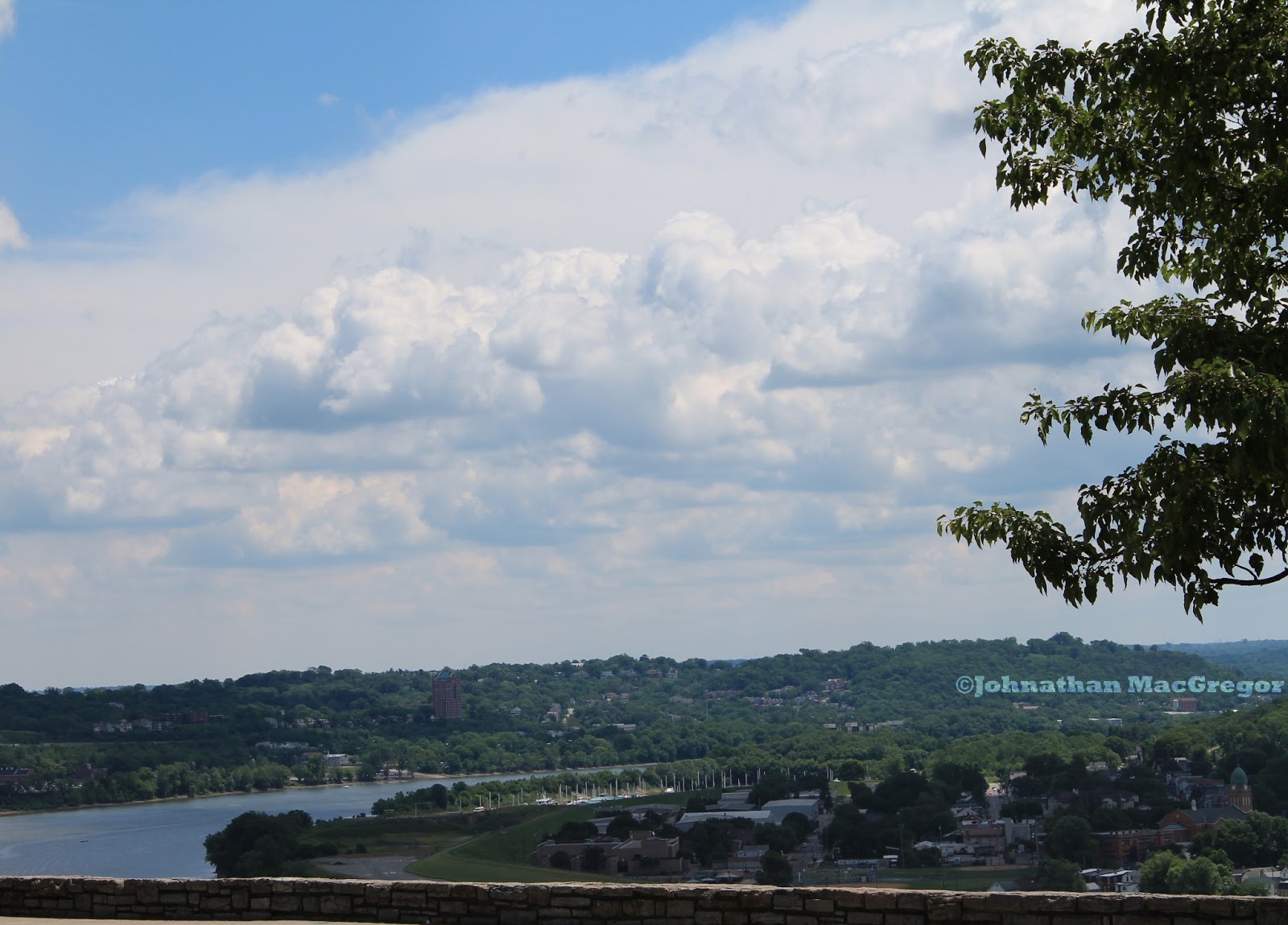
The views of the river are the best part of the Cincinnati landscape, in my opinion. This afternoon a snow storm was coming in added an interesting element. Chilly, but interesting all the same.


To the city's credit, Cincinnati does a good job preserving history, even as they revitalize parts of various neighborhoods. Signage on the landscape serves, to me at any rate, as physical footnotes to dig deeper--a clue that this spot was not always as it appears now. A place to start asking questions about what was.


The Mount Adams Steps originated as a path that Immaculata parishioners wore up the hillside to visit the church's construction site. The Archbishop Purcell put in a stair of wooden steps (probably a good thing from an erosion standpoint) and the city took over maintaining the thoroughfare sometime later. The most recent stairway was built in 2009.


When they built the landing with the markers, they included a photo of the skyline. Because there's very little reason not to, I took my own version.


I may not have been able to get the exact same angle and maintain the skyscraper focus but I don't think that really hurts the shot at all. I love how the sign pre-dates the Great American building.

Wednesday, March 19, 2014

Mini-post: Ault Park

Cincinnati has some great parks, and in Mount Lookout there's Ault Park. Created in 1911 and named for Ida and Levi Ault who donated the land and had served on the Cincinnati Park Board.


The pavilion was built in 1930, and in the summer months a fountain runs between the two staircases. It's an impressive, gorgeous structure--the snow fall just added to the charm.


Just a pretty picture of snow showers, with the flag for contrast. The wide open playing fields make the park a hub for activities during the warmer months.


The classy lamps look older than they are, but that doesn't take away from them. This was the point of the evening where the sun was almost down, the wind had picked up, and Joe and I were both ready to hightail it to Coffee Emporium.

Wednesday, March 5, 2014

Roebling Suspension Bridge--Cincinnati, OH

So everyone knows the Brooklyn Bridge, and how it was designed by John A Roebling. But where did Roebling get the experience to win such a bid? Well, in Cincinnati. Among other places.


One of the spiffy things about Cincinnati's location is how it's directly across the river from a river. This puts the Queen City at a wonderful cross roads--traffic up the Ohio, down the Ohio, from the interior of Kentucky, the interior of Ohio. Cincinnati was briefly considered as a replacement national capital after the British sacked DC during the War of 1812, and the fact it was smack-dab in the middle of all these key waterways (while still being out of range of Royal Marine expeditionary forces) was a big reason.


But all that river traffic was even worse than the current trainwreck that I-75 becomes two-to-four times a day now. Have you seen the steamboats of the mid 1800's? We're not talking a Honda Civic--we're talking a four story building on it's side, getting in the way of everything else that may want to cross the river. That made traffic between Ohio and Kentucky difficult--sure, you could ferry goods and people, but it just added to the congestion in a major way. Not to mention you couldn't always depend on the river to be high enough, or low enough, you needed a place to land those ferries...there are reasons we build bridges, people.


So starting in 1846 (I'm pulling these dates and names from Wikipedia, for the record--as much as I love history I suck at memorizing the details), the Covington and Cincinnati Bridge Company incorporated and called up John Roebling, who'd already designed and supervised the construction of several impressive spans around the country. It wasn't until 1856 that construction actually began--everything from lobbying against the bridge by the ferry operators to slow funding kept things at a glacial pace. Construction kept up at the same rate--between weather, funding, and health issues of key members of the Bridge Company work only took place during maybe a year and a half out of these 4 years.


The Civil War hit, halting construction. However, during the course of building defenses the Union Army built a pontoon bridge across the Ohio--proving to the community that a bridge might be a pretty good idea, after all. This solved the funding problems, and besides an invasion scare construction resumed in 1863. By 1866 the bridge was completed, paving the way for other spans across the Ohio River (see my banner photo).

Sunday, June 16, 2013

Eden Park Standpipe

One of the places on my list (probably the next one on my list) when that first camera got itself stolen was Eden Park. I mean, there's the obvious draw, the overlook on the Ohio...


...but for me that's just the start.  I didn't stop at Eden Park with the intention of shooting the Standpipe, but once I saw it, I had to cross the street and get a few more.


I had been aware there was a water tower at Eden Park, in the sense I've heard other people talking about it. I'd never really noticed it from Twin Lakes before, and had definitely never gone over to check it out. Looking over after shooting some ducks and geese, I saw this very unique structure sticking out of the trees.


I was fascinated. I spent a lot of time into castles as a kid (something most little boys can claim in common), so I was drawn to the arrow-slit windows, the battlements on the roof, the spire jutting above the main structure. I had absolute no idea at this point what this was, and spent a few minutes guessing before moving closer.  Part of some eccentric mansion? An observation tower for the army, or an astronomy organization? I did briefly consider "water tower," but had dismissed it because of all the windows--that's a lot of structure for very little holding capacity, it seemed.


I wasn't far off in that deduction, I found out later. The Eden Park water tower wasn't designed to store water--it was designed to regulate water pressure. The water system of the time was steam powered, and massive pressure spikes were a common occurrence. This tower provided an outlet for those spikes that didn't involve destroying water mains, by housing a water shaft in the center of the tower.

Evidently, this was an extremely common situation during the late 1800's and early 1900's. A website specifically about similar towers in St. Louis, Missouri provides more detail on the system, and some cool interior shots.

For more information about the steam engines that powered the Cincinnati water system at the turn of the 20th Century, Cincinnati Triple Steam.org has a wealth of information.


The Eden Park Standpipe was completed in 1894 and is 172 feet tall (supported by this formidable base). The tower was designed by Samuel Hannaford's architecture firm (the same man who designed Cincy's Music Hall and City Hall), and operated until 1916. Some pictures from the era show a copper spire (click here and scroll down to Page 30 to see it), but that's clearly gone now--recycled in one of the many scrap drives during World War Two. Just about all of this comes from a pretty well-cited Wikipedia page on the Standpipe, directly or indirectly.


There are several gargoyles on the Standpipe, including this roaring example here. I have a couple other shots on my Flickr account, such as this one and the two guys below.


I didn't see anything in my research that talked about letting the general public inside for tours, though I'd love to jump on that if the opportunity arose. There was a warning near the door about the dangers of screwing around with an active broadcast transmitter, and I'm sure that has a lot to do with it. Last time I checked, radio burns weren't any fun at all.